

'Opong,' now a severe storm, targets Bicol, Eastern Visayas
- Sep 25, 2025
- 2 min read
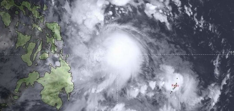
MANILA, Philippines, September 25 ------ Cyclone “Opong” (international name: Bualoi) heightened to a severe tropical storm early Thursday, September 25, as it moved west-northwest over the Philippine Sea toward the direction of Eastern Visayas, state weather bureau PAGASA said.
At 4 a.m., Opong’s center was estimated to be 440 kilometers east of Guiuan, Eastern Samar, packing maximum sustained winds of 110 kilometers per hour (kph) near the center and gusts of up to 135 kph. It was moving west-northwest at 20 kph. Strong to storm-force winds extend outward up to 450 km from the storm’s center.
Wind signals up:
Signal No. 2 (gale-force winds)
- Catanduanes
- Southern Albay
- Sorsogon
- Northern Samar
- Much of Eastern Samar
- Northern and central Samar
Signal No. 1 (strong winds)
- The rest of Albay
- Masbate
- Camarines Sur
- Camarines Norte
- Marinduque
- Romblon
- Mindoro provinces
- Quezon including Polillo Islands
- Metro Manila
- Parts of Central Luzon
- Calabarzon
- Bicol
- Eastern Visayas
- Northern Cebu
- Parts of Negros Occidental
- Iloilo
- Capiz
- Aklan
- Antique
- Calamian Islands
- Parts of Mindanao including Dinagat Islands and Siargao
PAGASA warned that higher wind signals may still be raised, with Signal No. 4 possible at Opong’s peak.
Rain, storm surge threats
Heavy rains are expected as Opong approaches Eastern Visayas and Bicol. A storm surge of 1 to 3 meters is possible within 48 hours in coastal areas of Aurora, Zambales, Bataan, Metro Manila, CALABARZON, Mindoro provinces, Marinduque, Romblon, Bicol Region, Northern Samar, Eastern Samar, Samar and Biliran. The enhanced southwest monsoon, or “habagat,” will bring strong gale-force gusts Thursday across parts of Luzon, Palawan, Visayas and Mindanao.
Opong is forecast to make landfall in the Bicol Region by Friday afternoon or evening, September 26, then cross Southern Luzon into Saturday. It may reach typhoon strength before landfall, weaken while crossing land, and re-intensify over the West Philippine Sea. The cyclone may exit the Philippine area of responsibility on Saturday afternoon or evening.
Source: philstar.com


Comments